Determining the angle of elevation of targets with the radar stations working in the range of metric waves, it is difficult due to the fact that the directivity feature is formed by reflection with the ground surface, and the antenna system has large dimensions and technically it is difficult to achieve rotation of the antenna in the vertical plane.
For the discovery LLC where the directivity feature is wide in the vertical plane, other methods can be used to determine approximately the angle of elevation or the height of the target.
Visibility diagram
It is the geometric place of the points in space that limit the volume in which, wherever the target is located, the signal reflected by it ends in good conditions on the radar station indicator. Usually, this diagram is represented in coordinates distance, height, taking into account the curvature of the Earth.
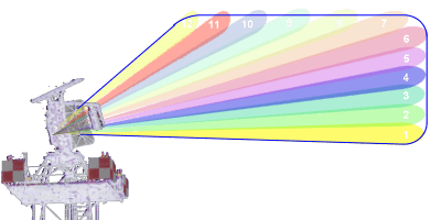
The method allows the determination of approximate values so that the visibility diagram also rises with great approximations, being made in the range of metric waves, with the help of reflection on the Surface of the Earth, for a position. The method may not be used for the continuous determination of altitude.